Geography: Difference between revisions
From Breaking Worlds
mNo edit summary |
(Maps) |
||
| Line 1: | Line 1: | ||
{{Categories|Geography}} |
{{Categories|Geography}} |
||
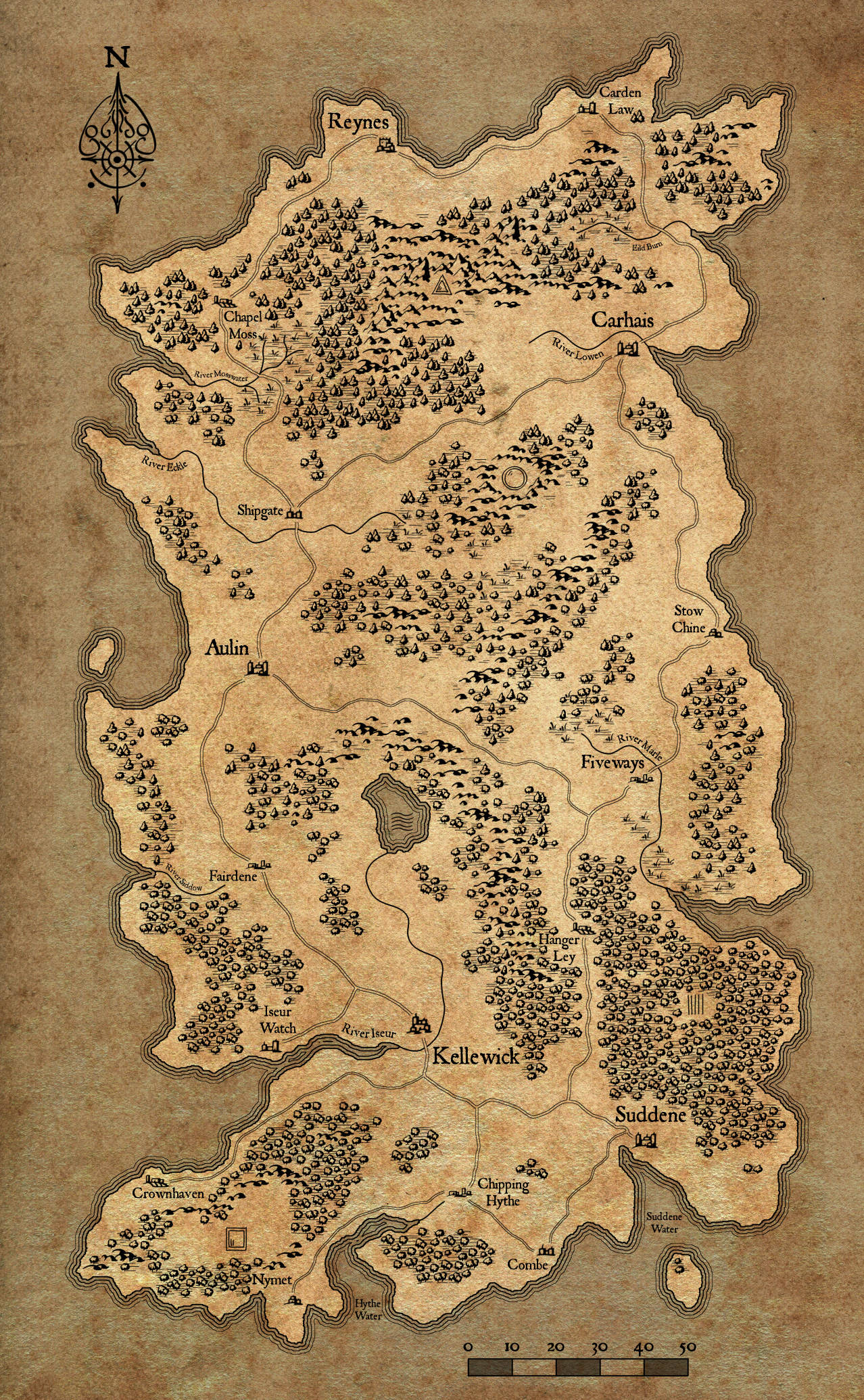
Although the [[Society|culture]] of [[Arginet]] is differentiated mostly by [[social class]] and [[Factions|political allegiance]], the various regions of the country each have their own character and customs. |
Although the [[Society|culture]] of [[Arginet]] is differentiated mostly by [[social class]] and [[Factions|political allegiance]], the various regions of the country each have their own character and customs. |
||
| + | |||
| + | As well as the country map on this page, maps of [[:File:Fiveways-IC.jpg|Fiveways]] and the [[:File:DowntimeMap.jpg|nearby area]] are available. |
||
Revision as of 16:27, 17 October 2017
Although the culture of Arginet is differentiated mostly by social class and political allegiance, the various regions of the country each have their own character and customs.
As well as the country map on this page, maps of Fiveways and the nearby area are available.
The Iseur Valley in the southwest is the political and mercantile heart of the nation, and the location of the capital city of Kellewick.
The Summer Coast is the fertile south of Arginet, where rich and poor are starkly divided and the effects of the Breaking are keenly felt.
The Eastern Reach is a once-quiet agrarian region, and the location of Fiveways, the central location of Breaking Worlds. The downtime map covers a large part of the Reach.
The Lowen Valley is a land of plain-spoken and industrious people in the northeast of the nation.
The Northlands are rugged and chilly, isolated from the rest of the country by mountains and tradition.
The Western Reach is a prosperous and conservative region and a stronghold of the old nobility.
The Interior is sparsely populated and lawless, troubled by bandits and beasts.